


Discovering how coastal ecosystems work—to keep them working
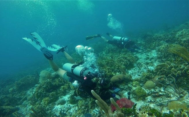 Climate change and biodiversity loss pose existential challenges to the health of marine ecosystems and the people who depend on them. Yet our scattered knowledge of marine life hampers our ability to effectively address them.
The Smithsonian is committed to solving this challenge. The Marine Global Earth Observatory (MarineGEO) is a unique network of partners around the world dedicated to tracking the vital signs of coastal marine life, diagnosing the causes of change, and informing science-based solutions to build coastal resilience—all using standardized, coordinated methods. Led by the Smithsonian’s Tennenbaum Marine Observatories Network, MarineGEO coordinates the research of partner observatories and project collaborators that span the globe.
Our research focuses on biodiversity because it is the heart of functioning ecosystems, but is missing or poorly coordinated in most marine observing. We focus on coastal systems nearshore because this is where biodiversity and people are concentrated and interact most.
MarineGEO is also a community—the network is people. Our value proposition to partners is: The Smithsonian helps elevate your science and grow your professional network to take local science global and to accomplish outcomes none of us could reach alone.
Learn more about MarineGEO by viewing our values, who we are, our governing documents, and current opportunities.

Long-term Monitoring
Measuring a suite of biological variables, long-term monitoring provides a shared, cross-network empirical foundation for detecting ecological change and informing experimental design. All observatories and monitoring sites collect comparable ecological data using standardized protocols in representative nearshore habitats, at least annually, with data curated and disseminated through the MarineGEO data system. Integrated analyses of these time-series data generate indicators of ecosystem condition and resilience, support consistent accounting of local and regional biodiversity, enable detection of trends and thresholds through time, and facilitate diagnosis of the drivers and consequences of ecological change.
Knowledge Synthesis
Data analysis, integration, and interpretation are central to transforming observations and experiments into actionable knowledge. MarineGEO’s distributed observatory design spans broad environmental, biogeographic, and anthropogenic gradients enabling quantification of large-scale patterns in biodiversity, ecosystem processes, and human impacts. These spatial and temporal contrasts are used to test hypotheses about the drivers of change, identify emerging risks, and project future ecosystem trajectories. Long-term standardized monitoring, targeted cross-regional research campaigns, coordinated experiments, and integrated remote sensing products collectively provide the empirical basis for synthesis outputs that inform ecological theory, conservation planning, and management.


Network Projects
Coordinated network projects provide mechanistic tests of hypotheses about the causes and consequences of ecological change and increase inferential power by leveraging replication across environmental gradients and spatial scales. MarineGEO develops these efforts as discrete, hypothesis-driven research projects that integrate monitoring observations with standardized experimental manipulations deployed by partners throughout the network. Network projects vary temporally and thematically and are explicitly designed to address priority questions identified by the MarineGEO community, primarily by the Working Groups. Project selection follows a recurring, bottom-up process in which MarineGEO members articulate research needs, propose study designs, and pitch them to the respective MarineGEO Working Group, followed by the Executive Committee, and then MarineGEO Central. MarineGEO Central facilitates implementation by providing coordination, modest material resources, and technical and staff support to the partner leading the project.
Knowledge Sharing
The co-creation of knowledge is a critical component of the network. We facilitate the exchange of information, skills, and experiences among partners through meetings, scientific and non-scientific conferences, trainings, and workshops. These opportunities allow network partners to learn from one another, strengthen collective expertise, and enhance monitoring, research practices, and methodologies. By sharing knowledge across disciplines and sectors, the network helps translate science into practical applications that can support more informed conservation and management decisions. This collaborative approach increases the impact of our work by ensuring that research findings, local knowledge, and innovative practices contribute directly to effective resource stewardship and sustainable solutions.
